GIS Mapping Valuation
Geographic Information System Mapping Valuation.
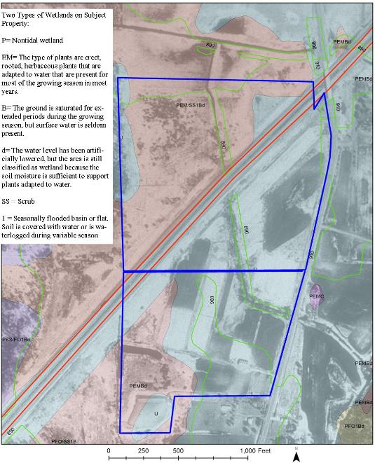
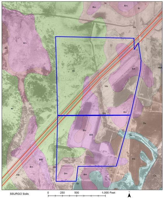
We have implemented the use of Geographic Information Systems (GIS) in our appraisal reports when applicable or requested. The use of GIS illustrates specifics of the property on a map such as: elevations, soil types, wetland areas/wetland types, and other property-specific attributes. All mapped attributes are fully explained within the appraisal report. All mapping and data used for explanation are acquired by the USGS, Minnesota DNR, or other reliable entities.
Wetland Mapping
|
Soil Type Mapping
|